"Alla capu te Acca" (To the cow's head)
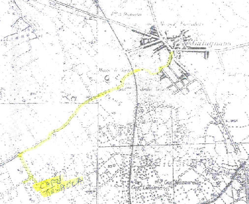
From via Foggiari, always keeping to the right-hand side without ever turning, you pass the "delle Lete" menhir, the level crossing on the Lecce–Zollino railway line and the Chapel of Our Lady of the Snow, continuing for about 2 km. On the right appears the small chapel of Our Lady of the Milk; taking the turning to the left, after 300 metres you reach a fork: carrying on leads into open countryside, turning right runs alongside "lu paritune" (the great wall). After about 1.7 km you meet the Lecce–Galatina road. From the menhir to the fork and back: 5.2 km.
"Alla Matonna te l'Angeli" (To Our Lady of the Angels, on the Sternatia estate)
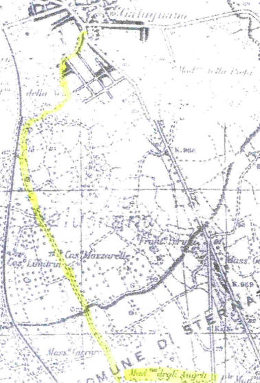
From via Foggiari, along the right-hand side, you reach the "delle Lete" menhir and turn left as far as the level crossing on the Lecce–Zollino line, continuing without crossing it: the area, where the road widens, is of considerable archaeological interest for the discovery of numerous Messapian tombs, possibly a necropolis. Nearby, the "l'eremita" (the hermit's) plot holds a curious period hut. The route continues towards the church of Our Lady of the Angels, skirting the "Palumbo" quarries and the "Mazzareddhre" farmstead. From the menhir and back: 5.3 km.
"Alla razzia te lu Beddhru" (To the raid of the handsome one)
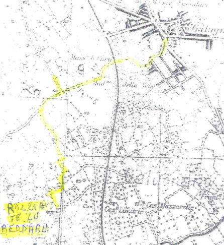
From via Foggiari, past the "delle Lete" menhir, the level crossing and the Chapel of St Mary of the Snow, turn left about a hundred metres past the junction for San Donato, passing beside the "Il Rifugio" farm holiday house, until you come out into open countryside at the "chiesura alla razzia te lu beddhru". From the menhir and back: 3.6 km.
"Alla Scaliddhra" (To the little staircase)
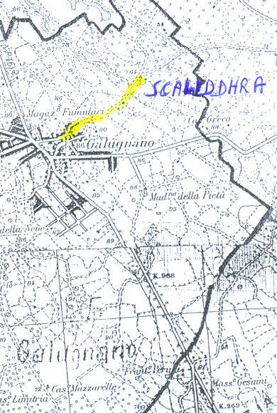
At the end of via San Salvatore, past the bridge over the Lecce–Maglie road, you pass the I.GE.CO. company depot and the olive-planted ridge that precedes "la scaliddhra": a steep descent whose ground forms a huge natural staircase, once covered by a Roman paved road now hidden under asphalt. Nearby, "lu puzzu te lu chianu", a 40-metre-deep spring-fed well, was, until the Puglia regional aqueduct arrived, the last reserve of water for the people of Galugnano. From the start of via San Salvatore to the Ussano–Caprarica junction and back: 1 km.
"Alla Specchia Caggiune o te lu Tiaulu" (To the ruined specchia, or the devil's specchia)
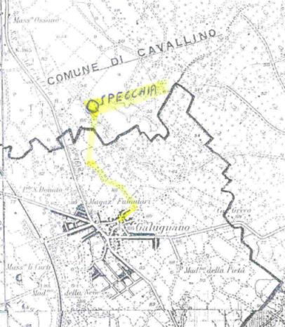
At the end of via San Salvatore, keeping left towards the television aerials at the top of the ridge, after about 400 metres of uncultivated countryside you reach the "specchia caggiune", also known as "the devil's specchia". According to local legend, at the centre of its crater lies a hidden treasure — a golden hen with twenty-one chicks — recoverable only by digging at midnight, on a full-moon night, accompanied by a priest and a goat: to this day, in Galugnano, anyone who tries to trick someone is met with the ironic retort "passa casa te Calimera!" ("off to Calimera with you!"). From the start of via San Salvatore, there and back: 1.3 km, plus 800 m for the specchia.
"Alle Menze" (Menza: a traditional copper vessel for carrying water)
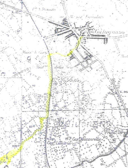
From via Foggiari, past the level crossing and the Chapel of St Mary of the Snow, turn left, passing a second level crossing as far as a small railway bridge, then right: over a kilometre among dry-stone field structures and the reddish outcropping rock of the Salento ridge, as far as a fork leading into open countryside. From the menhir to the fork and back: 5 km.
"Alle Taiate" (To the Lecce-stone quarries)
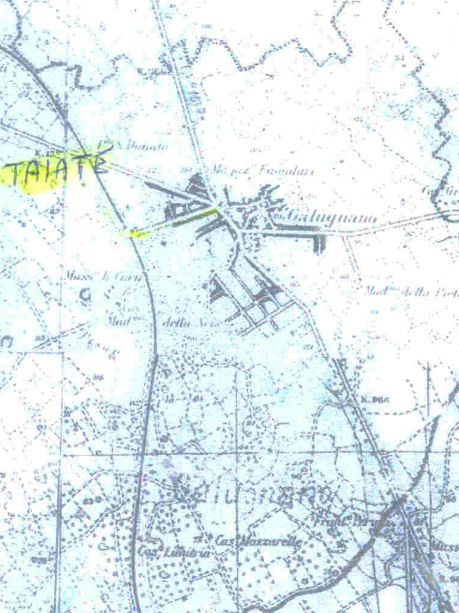
From via Foggiari, past the level crossing, turn right towards the "te le ore" farmstead (of the sinkholes), an area rich in disused Lecce-stone quarries — only one still active, though not visible from the road — and a fragment of an underground olive mill that operated until just after the war. Heading back you reach the "Curti Ecchi" menhir. From the end of via Foggiari to the menhir: 1.4 km.
"Allu Fundu" (To the Bottom)
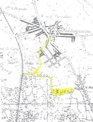
From via Foggiari, having reached the menhir and turned left, after about 400 metres take the first turning on the left: after a further 500 metres you come out into open countryside, opposite the Palumbo quarry. From the menhir and back: 1.8 km.
"La Strhata te le Madonne" (The Way of the Madonnas)
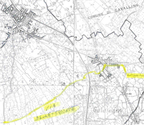
A route that touches in sequence the cemetery church of Our Lady of Sorrows (1675, holding inside a precious fifteenth-century "cunegghra"), the church of the Annunziata (1665, a jewel of Salento baroque), the "delle Lete" menhir, the Chapel of St Mary of the Snow (formerly "of the Pesanei"), and the "cunegghre" of Our Lady of the Milk and of Our Lady of Linzate, the latter now reduced to a ruin. From Our Lady of Sorrows to the Linzate cunegghra and back: 9 km.
"Sulla Sthrata te li Menhir" (Along the Way of the Menhirs)
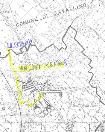
A route touching all three surviving menhirs of the area: "delle Lete" (4.70 m, the second tallest in Salento), "Curti Ecchi" (3 m, near the railway station) and "Ussano" (1.30 m), passing among dry-stone "paiari" and the two main junctions towards San Donato and Ussano. There and back to the Galugnano–San Donato road: 5 km.
"Sulli Siosti" (Above the Siosti)
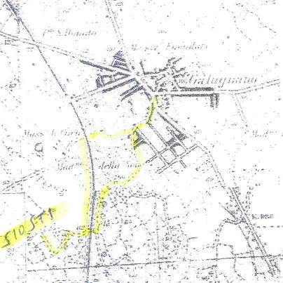
From the "delle Lete" menhir you climb towards "li Siosti", a viewpoint over the Galatina plain and over Galugnano itself, resting on the slopes of its ridge — an area where legend holds that "Napuli Picciccu" (Little Naples) once stood, along with an ancient cloister, perhaps the origin of the place-name. The route also touches the Abbey of St Mary of the Snow, mentioned in sixteenth-century documents in the Diocesan Archive of Otranto. Full route: 3 km.
"Versu lu Pizzu te Martignanu" (Towards the Martignano corner)
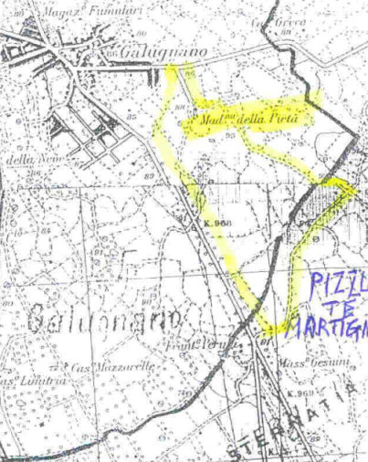
Towards Caprarica di Lecce, past the bridge over the Lecce–Maglie road, the route follows the expressway past the "Mille e una notte" restaurant and the wind turbine of the Puglia aqueduct, as far as the church of Our Lady of Sorrows — often called eighteenth-century but actually built in 1675 — with its plain baroque façade. From the Lecce–Maglie bridge and back: 4 km.
"'Ssutta li Porcili" (Below the pigsties)
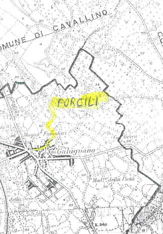
At the end of via San Salvatore, past the bridge over the Lecce–Maglie road, you come across a shapeless dry-stone "paiaru" — once also used as a summer dwelling, with a fireplace and cistern built into its thick walls — before descending into open countryside towards the Galugnano–Caprarica road, in an area once occupied by pigsties. From the start of via San Salvatore and back: 1 km.